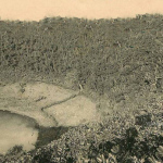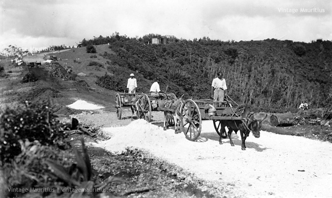
Curepipe – Trou Aux Cerfs – Concretising The Path Around – Promenade Georges VI – 1937
The Trou Aux Cerfs is believed to be a dormant volcano located in the upper parts of Curepipe and is said to be the highest part of the central plateau. The Trou Aux Cerfs bears its name since the early colonisers because of the deers coming to drench their thirst at the little lake at the bottom of the crater. It offers a magnificent view over the island. Being part of the important development of the flora research since the early 20th century, the climate within the crater has been for some time used to enhance some specific plant cultivation. The crater has also played an important part in the development of Curepipe. The outer slopes of the volcano which were once neglected lands are now highly praised, especially near Floreal.
The place has been well known since the 1870s to be a refreshing area for strolls and wanders in the woods. Access to the crater was then through rocky and uneven paths. During the Governance of Sir Wilfrid Jackson, this path round the Trou aux Cerfs was levelled and filled with concrete and tarr to ease the access and in view of providing a recreational area for the inhabitants. The picture shows the levelling and construction of the path round the crater and at that time, ox-carts were used to bring the materials uphill. The path, known as ‘Promenade Georges VI’ was inaugurated in 1937 by the Governor Sir Wilfrid Jackson himself.
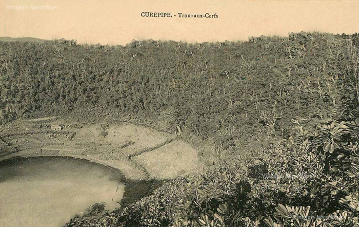
Curepipe – Trou aux Cerfs – 1890s