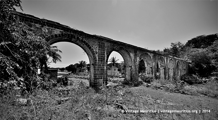
Grand River North West – Dayot Canal – French Colony – 2014
Most of us must have certainly heard about ‘Canal Dayot’ at Grand River North West, and this region at the suburb of Port Louis became even more popular during the flash flood of the 30th March 2013 where the water level rose so fast and high in only a few hours that many surrounding habitants faced severe material losses.
Fact is, the Canal Dayot region bears its name because of the real ‘Dayot Canal’, from the supervisory engineer Thomas Dayot, which was constructed during the french colony under the Governorship of Vicomte de Souillac (1779 – 1787) with the main purpose to provide the western part of the capital with fresh water supply. The aqueduct began construction in 1782 and became operational thereon. It was made to carry water across the St Louis River towards Port Louis centre. It was somehow later sold to the government in 1794. It was actually the second canal that was built during these times.
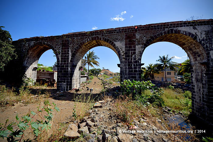
Grand River North West Water Canal – Thomas Dayot
During colonial times, Port Louis was supplied with fresh water from Grand River North West through canals. The first one was the work of Mahé de La Bourdonnais, who had an aqueduct and a canal built to carry drinking water from GRNW to Port Louis. This network served the Lodge, the harbour to provide water to ships on call and two public fountains for the convenience of the inhabitants. The works on the canal started on 15th November 1738 and the first conclusive tests were carried out on 28 February 1739. On 1st March of the same year, Mahé de La Bourdonnais inaugurated the canal which was then known as Canal La Bourdonnais.
This ‘monument’ is still visible today and can be seen here.


