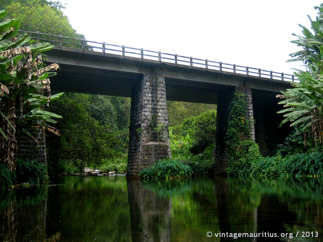
Found in the South of Mauritius, the Rivière des Anguilles Bridge is quite a magnificent and well known bridge today. Over its famous river, it was initially a wooden bridge during the early British occupation and was primarily used to allow the passage of ox-driven carts and stage coaches as indicated on a tourism panel nowadays.
With time and evolution, its structure showed to be too weak and insecure for heavy road traffic. In 1878, a new bridge standing on three piers was constructed. It stands at 105 feet (35 meters) above the river bed and spans over 241 feet (80 meters).

Information Sign of the MTPA at the side of the road to the River bank

Stairs leading down to the River Bank

Small dam at the river bank, bridge at the back

The Riviere des Anguilles River

Riviere des Anguilles Bridge

Riviere des Anguilles Bridge
Click here to locate the bridge on Google Map