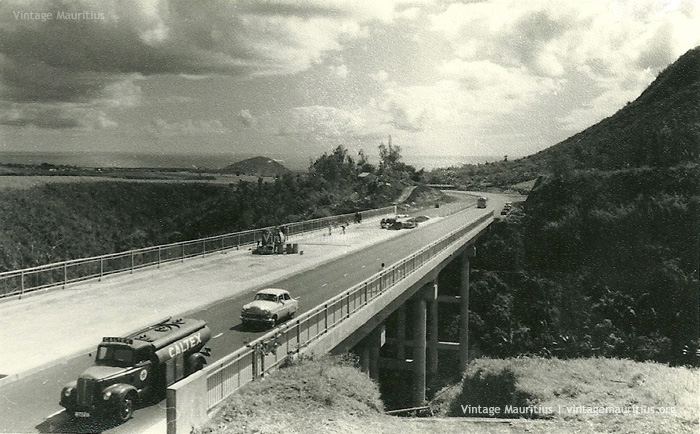
Construction of Motorway at Coleville Bridge – Montagne Ory – Mauritius – 1962
Since the early colonial days up to now, Mauritius has known many improvements and additions in the road network. In the beginning there were barely very few roads and the rest was natural forest. Little by little, whilst civilisation began to grow towards the centre of the island the road network as well began to expand.
The first motorway in Mauritius began construction around 1960 and was a direct link from Port Louis to Plaisance. The Construction took many years altogether and even today new road maps are being added nearly every few years (E.g: Terre Rouge – Verdun Link Road). Back in 1962, from the image (Courtesy of: Chris Pearce) we can see when the motorway at Montagne Ory, near Reduit, was still being constructed. At the same time the high bridge of Coleville Deverell crossing the Grand River North West was also constructed. This route can be categorised to be a landmark for the people as everyday thousands of inhabitants crosses this place to and from the city. The Coleville bridge, on another side, is ‘famous’ for quite some suicidal attempts. The old Caltex tanker lorry we can see is another vintage enthusiast admiration, even though none of these exists in the country nowadays.
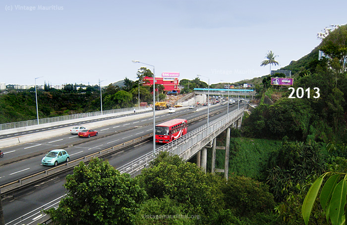
The same view during the recent years, can be seen below. At the same time, the motorway which was since a two-lane dual-carriage was being expanded to three lanes.

Mont Ory – M1 Motorway – Coleville Bridge – Mauritius – Now – 2013
Other views of the M1 Motorway in Mauritius then:


Click here to view our Motorway Album on Facebook
Click here for the original post on Facebook


