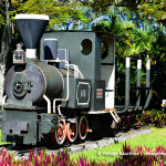
The Mauritius Government Railways started operating since 1864, but unfortunately after a century of operation it was dismantled in 1964, during which the Passenger carriages knew an end in 1956. The Last Passenger train departed on the 31st of March 1956. Goods Trains continued to operate until 1964 where it was then all removed. The tracks to the railways began to be laid since 1862.
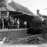
The Souillac Train Station in the late 1890s
Through this article we venture to discover the remains of the Southern Line as to what remains as of today (2014). The Southern line, mainly known as the Savanne Railway Line was among the last lines to be constructed. It began operation in 1878 and knew an end in 1954. At first glance, this line comprises of 5 Stations (including that of Rose Belle, being the departure station) and … yes, they also form part of the railway history, 8 Bridges.
The Stations are:
– Rose Belle Station (departure)
– Riviere du Poste Station
– Riviere Dragon Station
– Riviere des Anguilles Station
– Souillac Station (terminal)
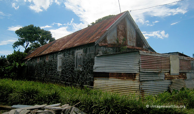
The Rose Belle Train Station
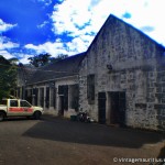
This station served as an exchange for the Savanne Line, which ended at Souillac, and a continuation of the Midland Line which ended at Mahebourg. Unfortunately since the last dismantlement there isn’t much left of the Rose Belle Train Station. Currently occupied by the Ministry of Public Infrastructure, and partly as a training centre we can still see as of today the Train Hangar which could accommodate up to 3 Trains, principally meant for repairs and inspections and another related building to the railways not sure for what purpose, according to witness of the train era in that region. The main landing station where passengers embarked or disembarked however no longer exists. The stone building that we see was then a pass-through for the trains (the hangar). After the dismantlement the entrances and exits where filled with concrete and with the windows we can see.


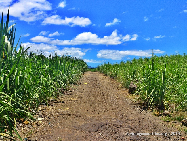
After Departure from Rose Belle, we encounter a first bridge among the sugar cane fields a little before Riviere du Poste Village. The stone bridge as seen below is completely abandoned and in ruin, and the tracks on the piers have disappeared as well, most probably removed during the dismantlement. This bridge was more or less like a mini viaduct as it was on a 3 pillar structure.


Leaving this first bridge, the tracks would continue again in between the cane fields, and through the current football ground of the village and leading again to the famous viaduct of the village.
Tracks trough the cane fields leaving the first Riviere du Poste Bridge
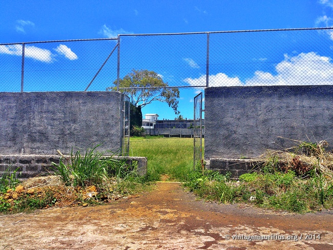
The Riviere du Poste football ground, back entrance after the railway tracks.
After leaving the football ground (as of today) the train would now be reaching a very scenic view, the train would be going over the Riviere du Poste, the actual name of the river, by the Viaduct, or in other words, the second bridge of the journey.


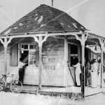
Within a few more minutes (or seconds) we reach the first station, the Riviere du Poste Station. Unfortunately, the current building is modern, which is understood that the old station was demolished and replaced by the new building which is now serving as the current Post Office and Community Health Centre.


As soon as we leave the Station, the route knows another bridge (the third bridge) through the cane fields. It is somehow sad that these bridges aren’t much mentioned in many sources and are qualified as minor bridges, but when viewed on the spot they are truly magnificent structures with a refined craftsmanship.

The Riviere du Poste Stone Railway Bridge
As the train continues, a fourth bridge appears. This time it is a smaller bridge compared to the previous two, still of stone structure. Currently we can say it is between banana fields.


We have now left Riviere du Poste village and approach Britannia, also known for its Sugar Mill (now Estate). Before entering the village, or nearing the Sugar Estate, it is concluded that there is route exchange at this point; passenger trains are swapped on another track leading to the Riviere Dragon Station and over the main Riviere Dragon Railway Bridge, and trains/carriages having to trip-stop at the Sugar Estate, probably for dropping sugar canes or collecting sugar are redirected through another minor, if it can be said so, bridge. Each of these routes are shown below.
The Riviere Dragon Train Station
Referring to this as the first exchange, the Train then approaches the Riviere Dragon Station, and good to say, this Station still exists today, abandoned for sure and squatted by homeless people. A good observation though, this station was quite big in size.


After leaving the Riviere Dragon Station, the tracks lead to some stone building, very likely related to the railways but no information could be obtained on them. The current residents have no idea of what it was, they just know they rent it and occupy the surrounding lands for plantation.
Stone Building after the Riviere Dragon Station, related to the tracks
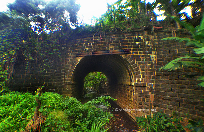
Just a few seconds afterwards, the train approaches and passes over the Riviere Dragon Main Bridge. High enough but rather short, this bridge is no longer used, not even as a pedestrian bridge as it lies too far from the main road and rather near the fields. Only the residents of the region from time to time might go on the bridge to relax and admire the running water. Additionally, the bridge is being used primarily by the Water Authority for running the pipes.


Now, coming back to the exchange point, and identifying this as being the second exchange, we see that instead of leading to the Riviere Dragon Station, the tracks lead to a different bridge and thereon to the Britannia Sugar Estate.


In the image below we can see the remains of the Railway Tracks entering the Britannia Sugar Estate. But it is most certain that these tracks were mainly meant to support tramways instead of regular trains due to their width.
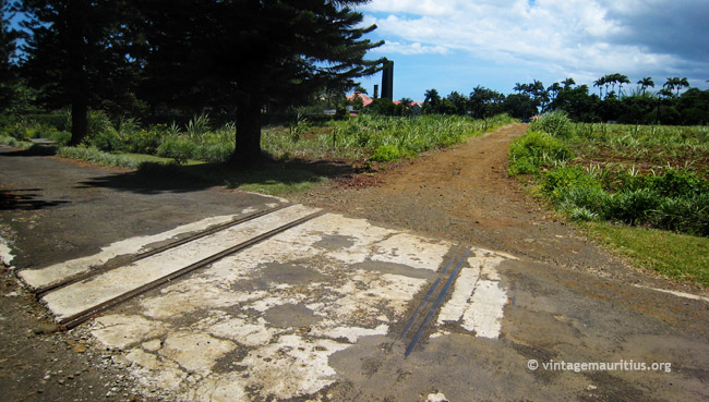
Railway tracks entering the Sugar Estate, seen at the far end.
After leaving the Riviere Dragon Bridge (or Britannia Estate), and midway between the next village of Riviere des Anguilles, the train crosses again a small bridge, the sixth bridge of the journey. Similar to the small bridges, this one too might go unnoticed as it goes well below the regular track level.


We now reach the Riviere des Anguilles village and the next stop also. The Riviere des Anguilles Station can still be seen today, even though abandoned. The translucent part on the image is a simulated representation of where the tracks were.
The Riviere des Anguilles Train Station
We are already at 70% of the journey and now leaving the Station the train continues through some residential area midway to the green fields of sugar cane. The next scenic view crosses the Riviere des Anguilles river via the Railway Bridge, the Riviere des Anguilles Railway Bridge. If there is one place during this voyage where you should be holding your breath, then this is it. The Train crosses one of the highest railway bridges of the island and a very scary one too. The height alone gives the chill… This bridge is still used as an access bridge and road to the St Aubin Sugar Mill instead of the Main road to alleviate the traffic from big lorries. Sometimes when we see these big lorries crossing the bridge makes you not wish to be in the place of the driver.


We are now also in the Village of St Aubin, where the next Sugar Estate is also. The Railway track passes in front of the Estate and only a few minutes after we cross the last bridge of the journey, the Bain des Negresses Bridge (if that’s really its name…?). We might not be influenced by this last bridge as was the case with the previous one, but it is as interesting to mention; completely out of stone again, it is worth a look… Weird thing though, the place has been so covered with trees and raised lands that this bridge might go unnoticed as from above it looks of same level as the road that leads away.
The Bain des Negresses Railway Bridge.
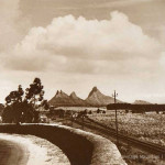
We are now reaching the end of the journey as the train does a huge ‘detour’ to enter the Souillac village, through the fields again, and to the final station, the Souillac Railway Station. This Station fortunately is quite well preserved and used at the Post Office of the Village, and we must also say that before entering the Station there is another building worth mentioning… the Souillac Police Station, having a different interesting story in its own.
The Souillac Train Station (terminus)
")


Are you familiar with Google Earth? Then you can download the KML File by clicking below to locate all the mentioned subjects, including the line, the stations and the bridges. Or even if you are not but you have Google Earth installed, then download and double click on the file, that should do it.
If you think we have missed anything, feel free to comment or tell us about it. It will gladly be included and referenced to you.